
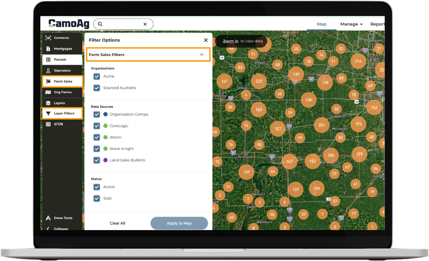
Generate precise sales analysis in minutes—up to 80% faster than traditional methods—with real-time public and private sales data, soil maps, crop history, and topography overlays, all backed by reliable Midwest sources like Land Sales Bulletin.

Capture confidential or off-market sales directly—build a competitive edge with private comps accessible only to you or your team. Enhance public records into enriched, proprietary comparables that set your listings apart.

Share interactive CMAs, maps, and reports with clients and colleagues through secure links. Collaborate in real time and keep your team aligned.

Enjoy a smooth workflow between CamoAg’s geospatial data and AgWare’s appraisal report generation, making your process more efficient than ever.
Nemo enim ipsam volupta quia voluptas sit asperna.
Nemo enim ipsam volupta quia voluptas sit asperna.
Nemo enim ipsam volupta quia voluptas sit asperna.
Nemo enim ipsam volupta quia voluptas sit asperna.
Nemo enim ipsam volupta quia voluptas sit asperna.
Nemo enim ipsam volupta quia voluptas sit asperna.

Leverage detailed mapping and tracking of relevant sales, enhancing the precision of every appraisal.

Access a wealth of rural land information, from USDA subsidy payments to UCC filings to FEMA flood maps, all integrated into your appraisal workflow.

Stay connected and upload crucial data directly from the field. Download the new CamoAg iPhone app to access your saved contact info, parcels and addresses while on the go.