
 Upstream Ag: “CamoAg -- A Commercial Catalyst for Agribusiness”. Click here for the full report.
Enrich producer data.
Discover new leads.
Understand your market.
CamoAg gives you advanced geospatial tools and producer intelligence on one million US operations to power smarter decisions across ag sales, lending, and land valuation.
1M+
Operations
800M+
Analyzed
150M+
Researched
.png)
Enrich producer data.
Discover new leads.
Understand your market.
CamoAg combines advanced geospatial tools and producer intelligence on one million US operations to power smarter decisions across ag sales, lending, and land valuation.
1M+
Operations
800M+
Analyzed
150M+
Researched
Leading Ag Companies Across Retail, Inputs, Lending,
and Real Estate Trust CamoAg


Built Exclusively for Ag Sales & Marketing
See how CamoAg works for your team.
Find New Customer Opportunities
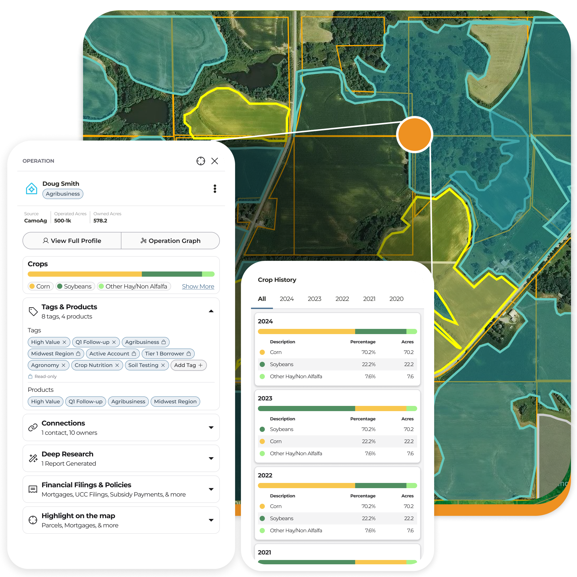
Search across one-million US farm operations and quickly access detailed information such as aggregated owned acres, approximate operation size, crop history, location information, and more.
Segment & Reach Producer Audiences with Greater Precision
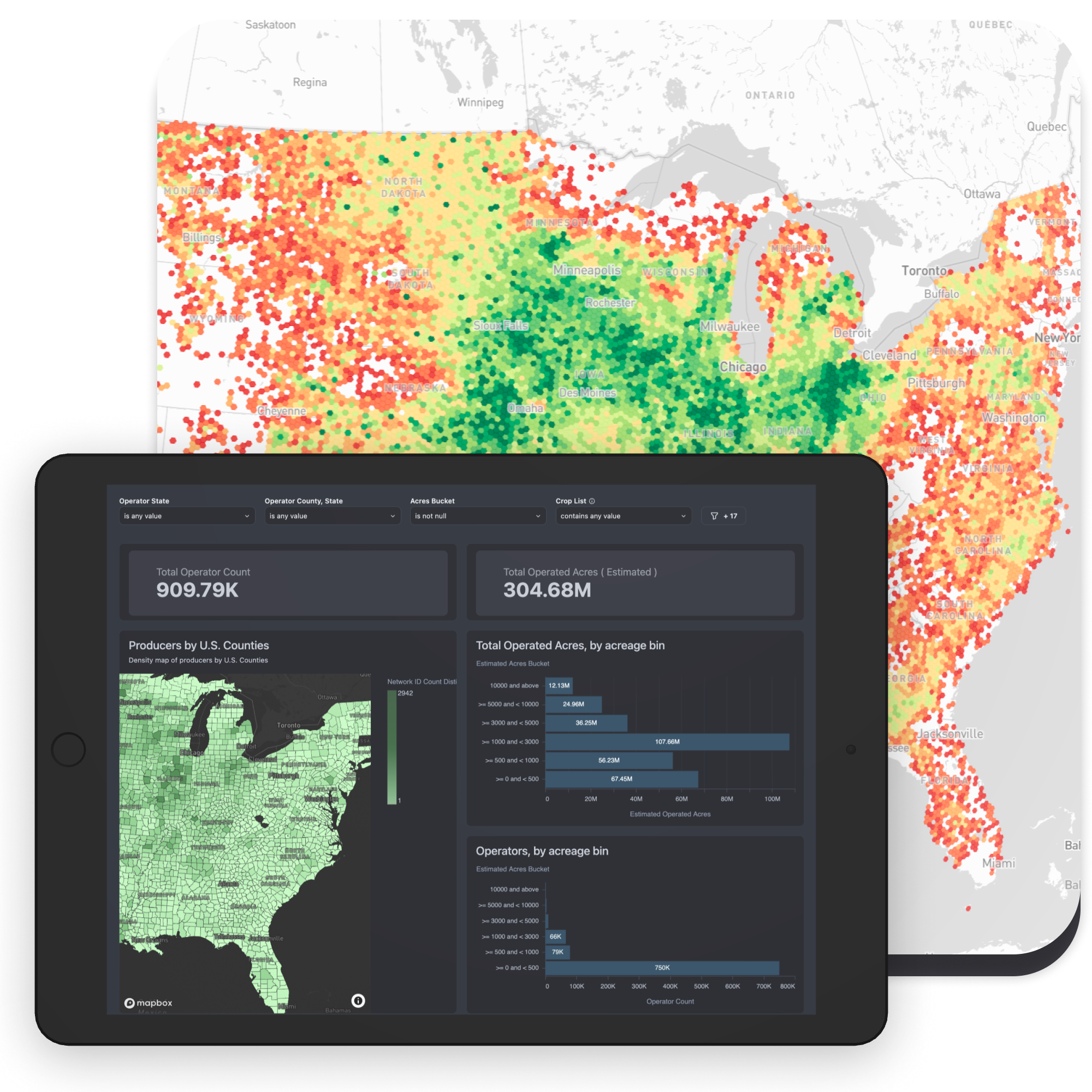
Create target audiences of farmers and landowners based on location, operation footprint, acres, crop type, ownership profiles, and more.

A More Accurate View of Your Customers
Field sales reporting and survey data often leave gaps in customer understanding. Fill gaps, enrich datasets, and see a more complete market view with CamoAg.

Built Exclusively for Ag Sales & Marketing
See how CamoAg works for your team.
Find New Customer Opportunities
Search across one-million US farm operations and quickly access detailed information such as aggregated owned acres, approximate operation size, crop history, location information, and more.
Segment & Reach Producer Audiences with Greater Precision
Create target audiences of farmers and landowners based on location, operation footprint, acres, crop type, ownership profiles, and more.
A More Complete View of Your Customers and Opportunities
Field sales reporting and survey data often leave gaps in customer understanding. Fill gaps, enrich datasets, and see a more complete market view with CamoAg.
Search & Discover with AI
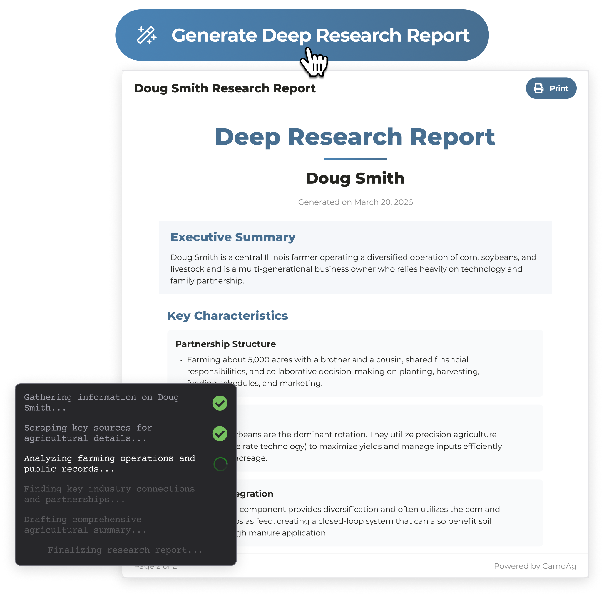
AI-powered Deep Research Reports available on every operation allows you to personalize sales visits to get the right products on the right acres.
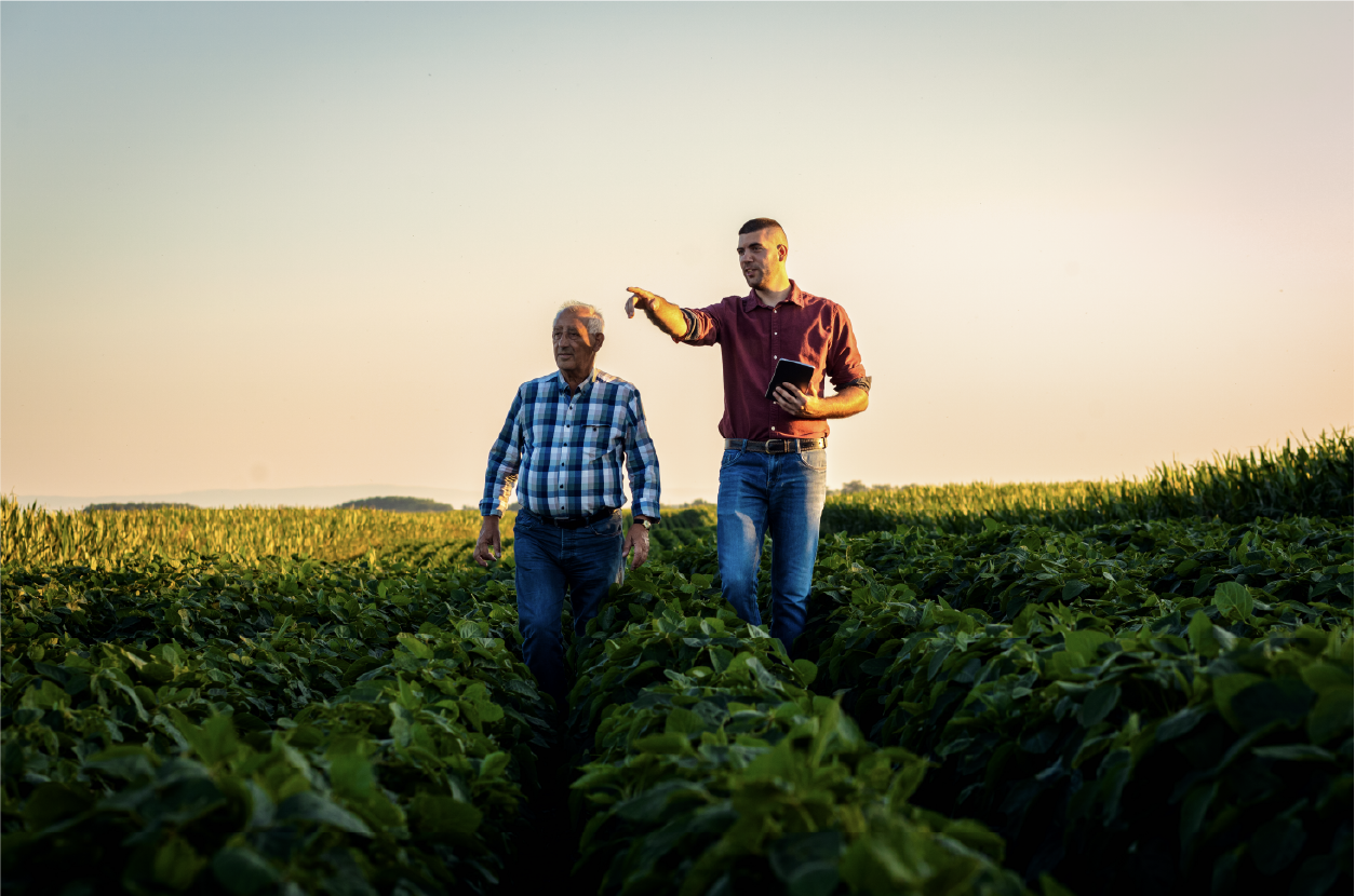
Tools Made for Field Sales Teams
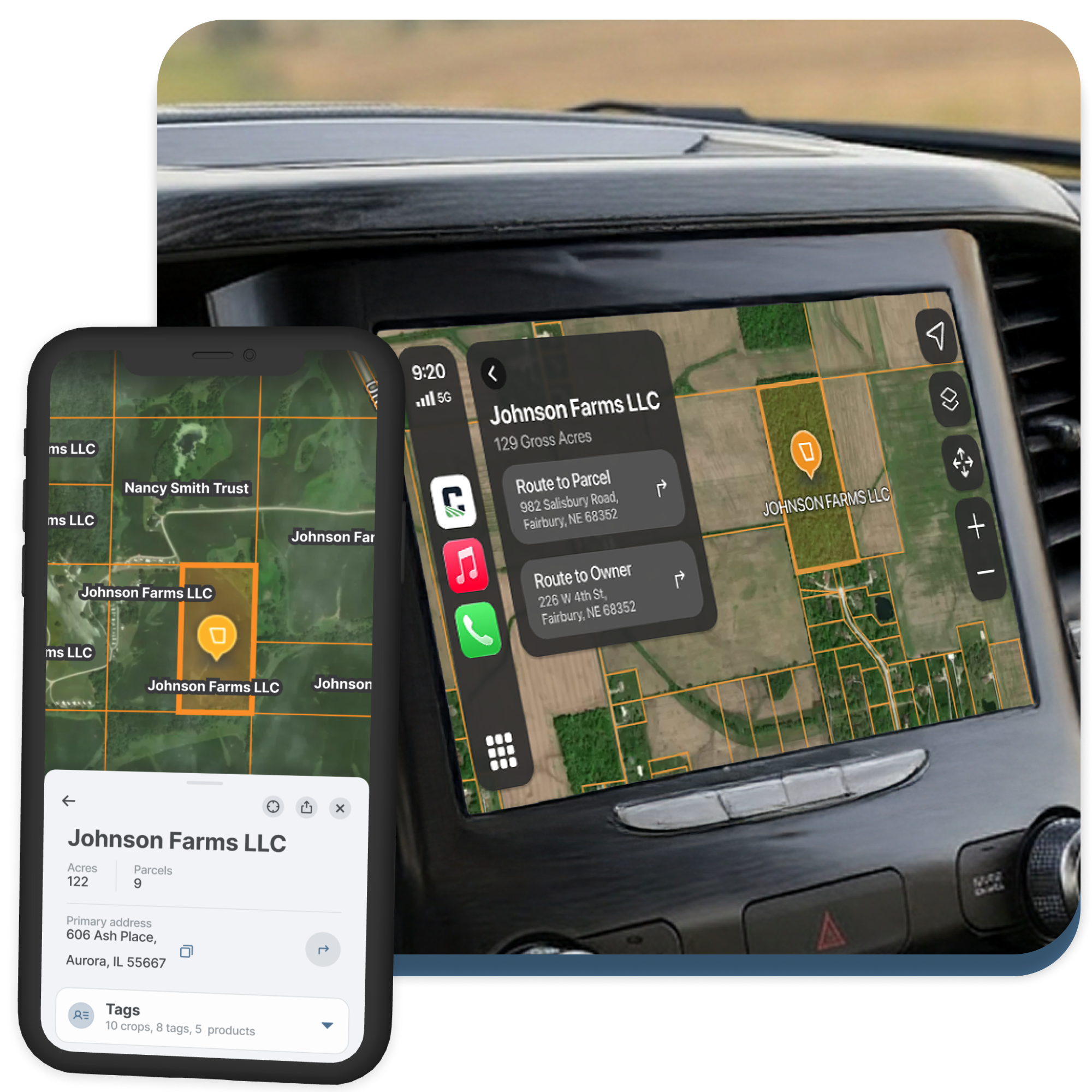
The CamoAg iOS app with CarPlay puts all of your producers in your pocket and on your truck screen. Easily find mapped locations, access contact and farm info, and see property lines and ownership records.
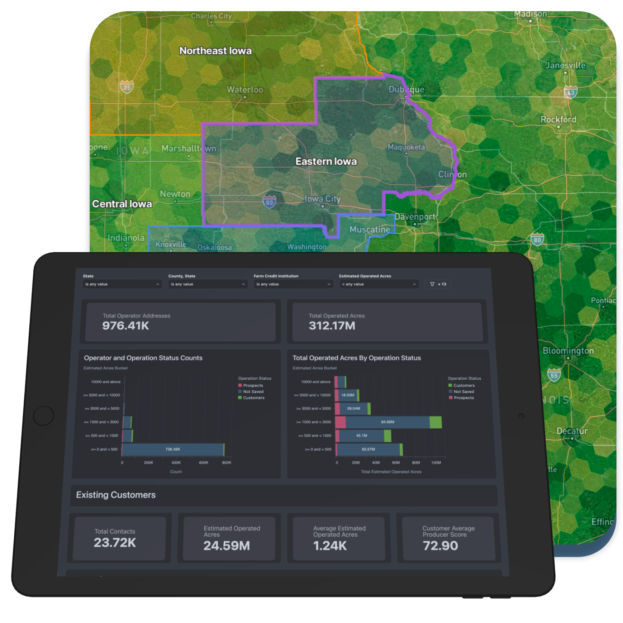
Find Your Next Share of the Market
Understand your customer gaps and market growth opportunities to better direct sales and marketing resources.
Who We Serve
CamoAg is Purposefully Built for Ag Sales and Marketing Professionals.
The CamoAg team created an advanced platform for busy sales and marketing folks to quickly get the information they need and set plans into action. Our team draws from deep experience across agriculture, data analytics, geospatial sciences, and agtech. We’re in it with you and want our customers to succeed.
Ready to understand your full market?
Get started on your own or book a demo to learn more.