
CamoAg’s GIS-based mapping tool is designed to significantly enhance the efficiency and effectiveness of agricultural businesses across sales,operations, and
Automate farm mapping, saving time on drawing production acreage.

Download Map PDF
Easily download and save map PDFs from CamoAg maps.

Open Farm in Google Earth
Access high-quality farm imagery via Google Earth for detailed research.

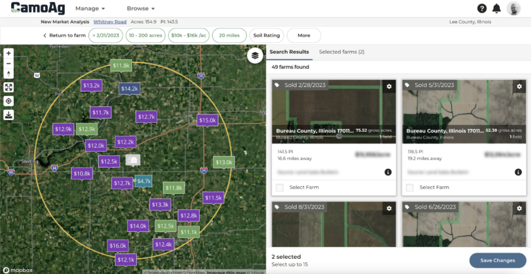
Identify and Research Prospects
Visualize and research prospects on a map based on proximity or specific agricultural data to identify gaps and high-potential areas for new business.
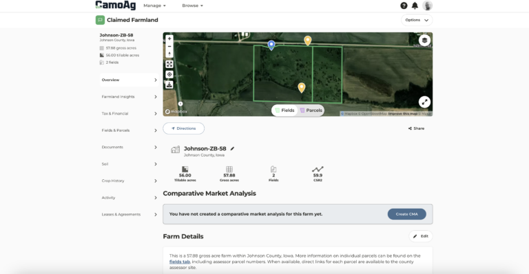
Manage Farms Digitally
The digital platbook within CamoAg’s mapping tool modernizes how farm operators and managers track and manage land. It consolidates all essential property and land management data into a single, accessible platform.

Conducting Comprehensive Land Analysis
A powerful resource for appraisals, offering the ability to research and map nearby farms and points of interest with precision when assessing land value and creating comps.

This monthly series will demonstrate new features that have been released so your organization stays up to date on the latest and greatest that CamoAg has to offer! Click on the button below for more information and to sign up.