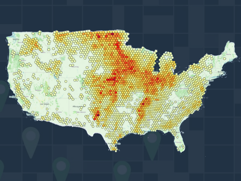
Beyond Traditional Mapping: Leveraging H3 for Accurate Agricultural Market Insights
In the agricultural industry, where success is increasingly tied to data-driven decisions, innovative technologies like the H3 grid system offer a more accurate way to map and understand large farm operations. Originally developed by Uber, H3 applies a consistent, hexagonal grid over an area, eliminating the inconsistencies of county or region-based maps. This system helps visualize critical data with greater precision, particularly for producers managing over 1,000 acres.
Everything in Agriculture is Geospatial
In agriculture, location drives everything — from soil quality to climate conditions. Geospatial data is essential for making informed decisions about where, when, and how to invest resources. The phrase “everything in Ag is geospatial” reflects that any farm operation’s success hinges on the land’s characteristics. So how can agribusinesses use this data to better understand their market and find the right customers?
Geospatial data provides a map of relationships — between markets, customers, and land. Agribusinesses have access to data sources like satellite imagery, soil maps, weather data, and land ownership records, which, when combined, offer a detailed view of the agricultural landscape.
With platforms like CamoAg, agribusinesses can merge their internal data with public and third-party geospatial data to create a comprehensive market view. For example, CamoAg aggregates data on land ownership, crop production, farm size, and USDA subsidies, giving teams the insights they need to target the right customers effectively.
Identifying and Targeting the Right Customers
Traditional marketing tactics in agriculture were often generic, but geospatial data now allows for more precise targeting based on farm characteristics like acreage and location. For example, a supplier selling farm equipment can use data to identify large operations that manage over 1,000 acres. Similarly, an ag lender can target borrowers based on land size and financial history, tailoring their products accordingly.
This data-driven approach focuses resources on the best prospects, leading to higher sales efficiency and stronger customer relationships.
Visualizing Market Opportunities with H3
Geospatial mapping with tools like H3 gives agribusinesses the ability to visualize market opportunities clearly. H3’s grid structure applies a scalable, consistent system across geographical areas, making it easier to compare data without the need for normalization. This visualization helps teams identify patterns that would otherwise go unnoticed.
For example, a seed distributor might use H3 to identify underperforming regions based on soil data and tailor their marketing efforts accordingly.
H3’s Benefits for CamoAg Customers
H3’s consistent, hexagonal grid is a perfect fit for CamoAg’s platform, offering precise, scalable geospatial insights. By integrating H3 with the platform, CamoAg users can adjust the hexagon size to match their data needs, whether they’re assessing land ownership across a state or drilling down into individual farm operations.
For sales and marketing teams, this means they can target the most valuable prospects with accuracy. Lenders and investors can use H3 to visualize risk and opportunity based on land valuation, USDA records, and operational data, making smarter, data-driven decisions.
In conclusion, geospatial data and tools like H3 are transforming the way agribusinesses find and serve their customers. By using CamoAg’s platform with H3, businesses can unlock actionable insights that lead to better decision-making and ultimately, greater success.

