
See US Agriculture Like Never Before
Explore farmland at your fingertips
150M+
Researched
800M+
Acres Analyzed
1M+
Operations Mapped
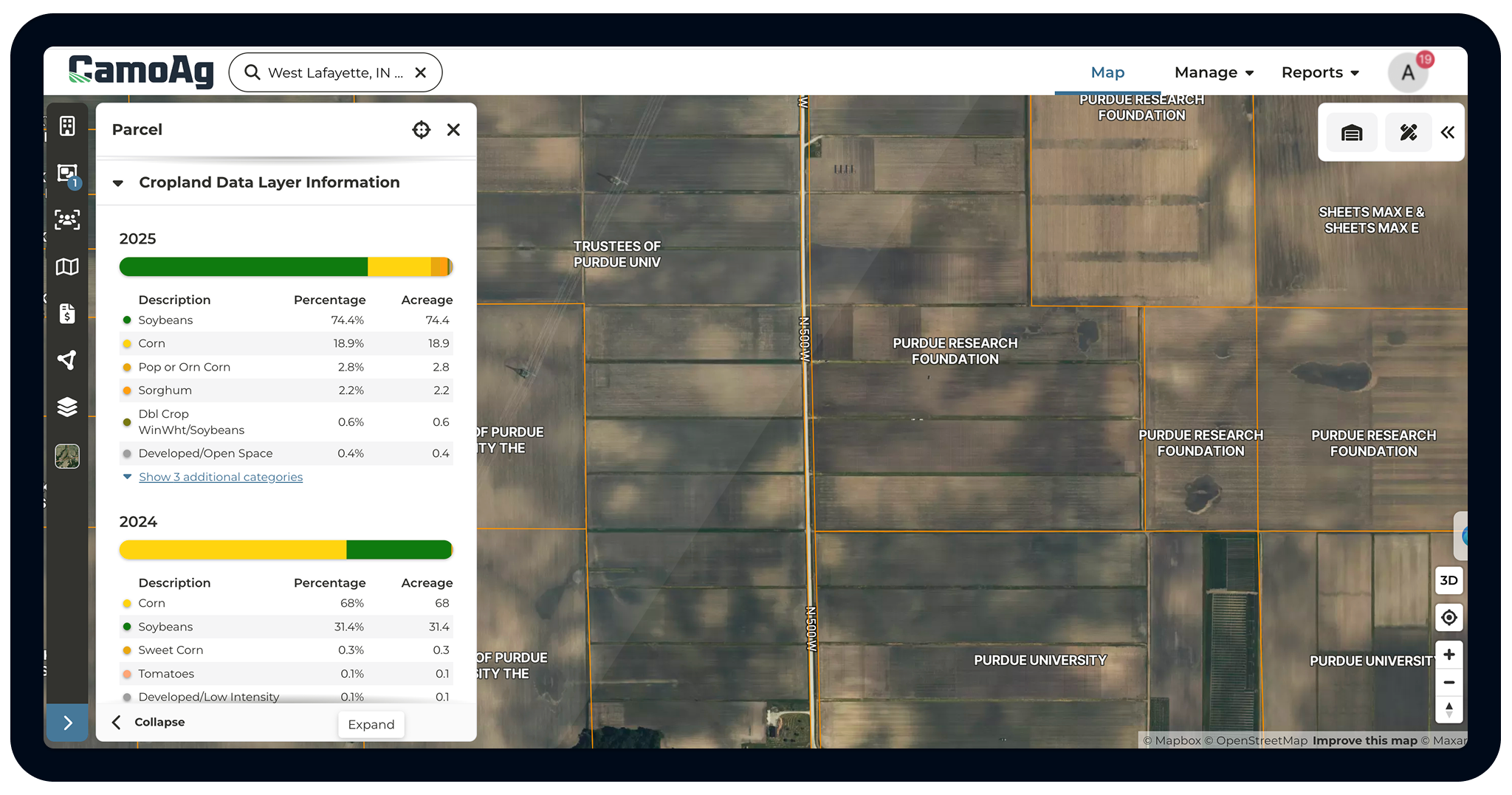
All in One View: Property Lines, Ownership Records, and Crop History
CamoAg puts it together, pre-loaded with:
- Owned vs. operated land identification
- Crop history by field
- Tax pins, assessor data, and parcel boundaries
- Householding ownership across entities, family groups, and state lines
Add the Layers That Matter to Your Work
One map, dozens of data dimensions built in. Toggle on the layers relevant to your work. Everything stays in context on the map, so analysis that used to take hours now takes minutes.
Core layers:
🌾 Crop History (CDL) — year + crop type filters
🏡 Parcel Ownership & Boundaries
🌱 Soil Data (SSURGO)
💧 FEMA Flood Hazard
🌿 Wetlands
🛰️ Satellite Imagery
🗺️ Historical Imagery (Google Earth basemap)
📈 Government Payments
🏔️ Topography & Contours
⚡ Transmission Lines
🏛️ Federal & State Lands (new — May 2026)
🏦 Farm Credit Institutions
👤 Contacts & Customer Pins
📦 Points of Interest
Available as add-ons:
🚜 UCC Equipment Filings
💰 Mortgage Data
Find Any Parcel, Any Way You Know It
CamoAg lets you search the way you actually work. CamoAg search surfaces both the contact name and the registered legal owner so you always find what you're looking for, even when entity names differ from your contact records.
- Search by name, address, APN, or Section-Township-Range (STR)
- Parcel PIN, assessor ID, zoning codes, and land use classification on every parcel
- Direct links to county assessor systems where available
- Owner mailing address from parcel records
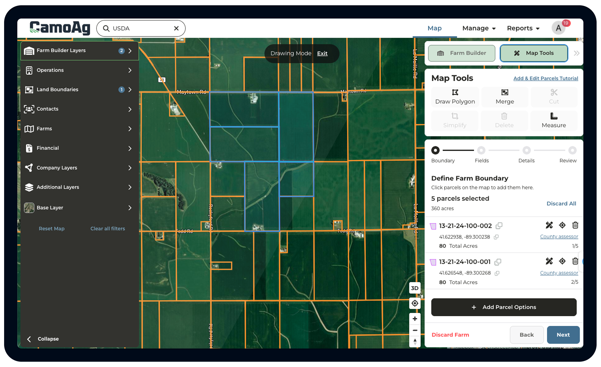
Not Just a Viewer, A Working Platform
Draw, edit, and save customer field boundaries and manage whole operation profiles all in one place.
- Boundary editing includes cut tool, draw polygon, and move field
- Add irrigation pivot and structure point-drops
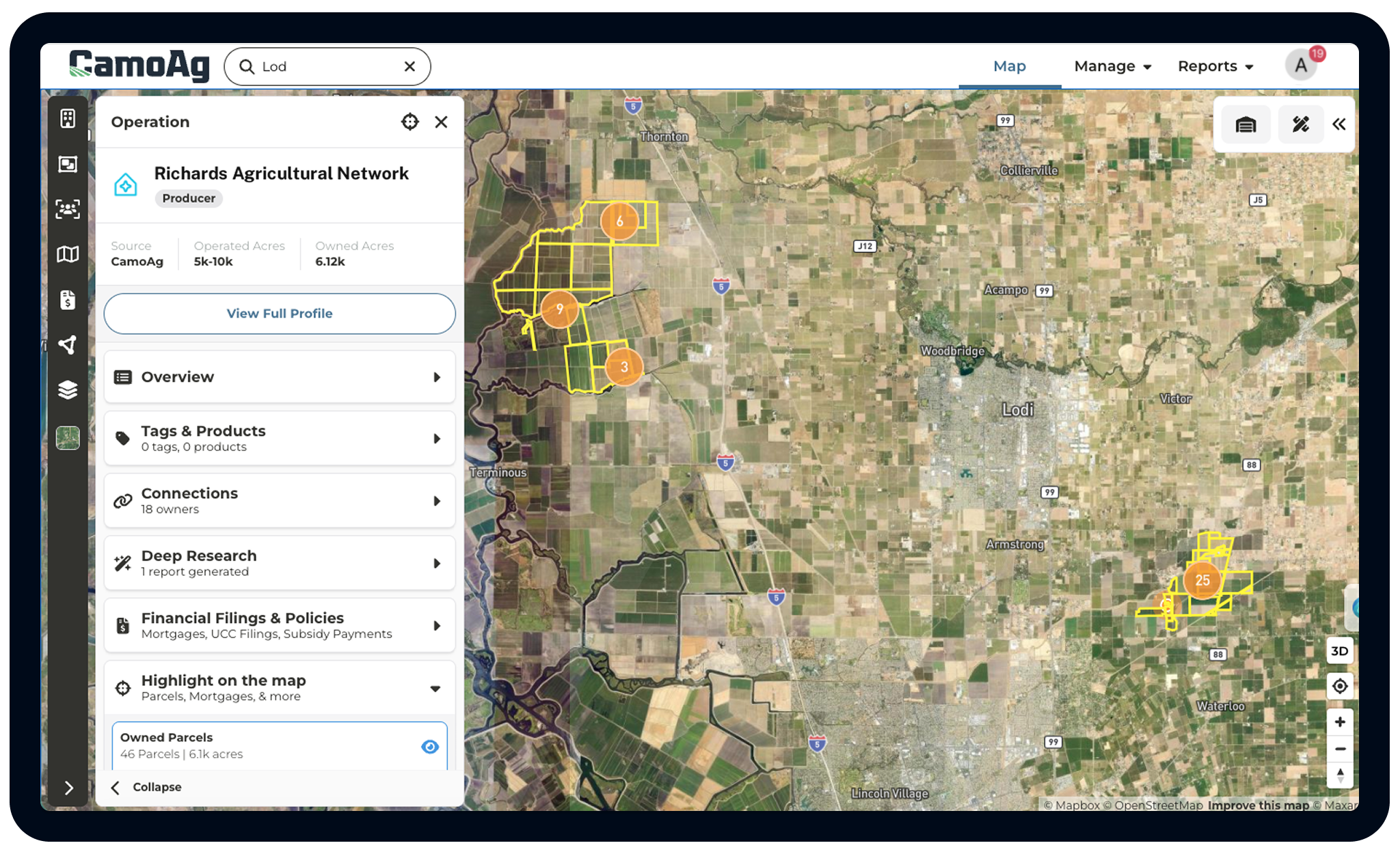
See a Fuller Picture of Any Farming Operation
CamoAg aggregates owned and operated land across multiple parcels into a single operation view. Know the total footprint, estimated acreage, and crop mix before you ever make a call.
- Aggregated operation footprint across connected parcels
- Multi-county and multi-state operation mapping
- Estimated total operated acres
- Crop mix and land use at the operation level
Built to Get the Answers You Need Quickly
Whether you're prospecting, appraising, or building marketing plans, the CamoAg Maps fits how your team works.

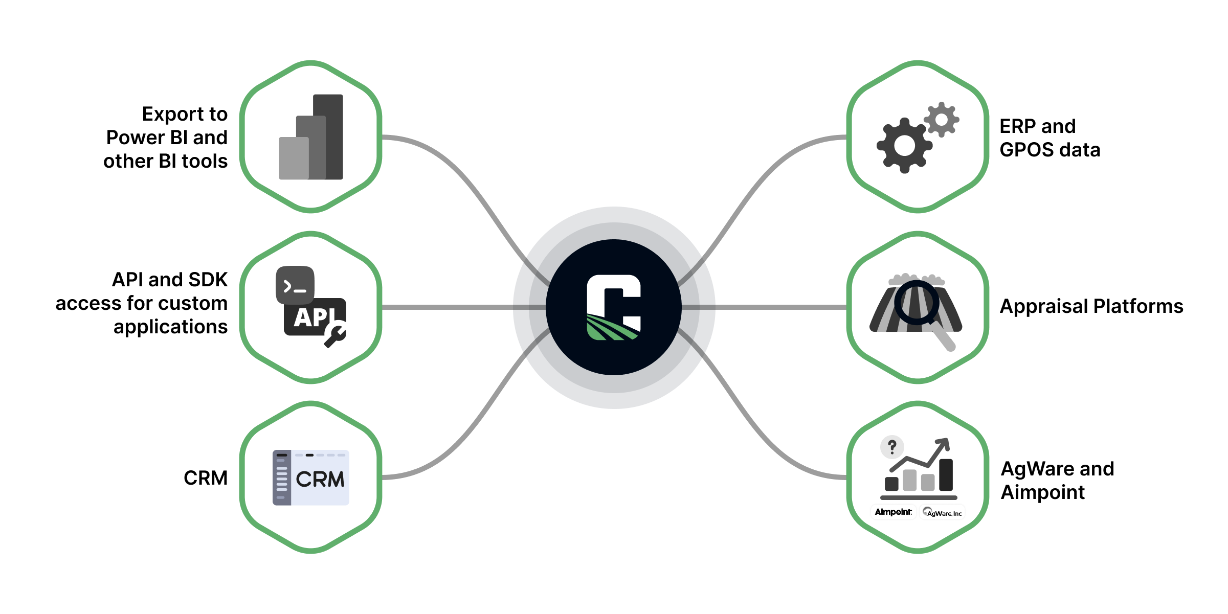
Your Data + CamoAg Data = A Complete Picture
CamoAg integrates with leading CRMs, ERPs, appraisal platforms, and ag data sources like AgWare and Aimpoint. Enrich your existing customer and prospect records with the exclusive CamoAg Producer Data Layer to uncover new customer opportunities.
- First-party data sync (CRM, ERP, or other licensed datasets)
- Export to Power BI and other BI tools
- API and SDK access for custom applications
Leading Ag Companies Across Retail, Inputs, Lending,
and Real Estate Trust CamoAg


Ready to understand your full market?
Get started on your own or book a demo to learn more.